Pakistan’s Karakoram Highway
The Karakoram Highway (KKH), sometimes known as the "Eighth Wonder of the World," is a remarkable and massive achievement of engineering that spans over 1,300 kilometers (810 miles) through some of the world's most difficult and breathtaking terrain. This historic highway connects Abbottabad, Pakistan, to Kashgar, China's Xinjiang region, passing through the spectacular Karakoram Mountain Range and the Himalayas. The Karakoram Highway is an important artery for transportation and trade in the region, and it represents Pakistan's outstanding architectural prowess as well as its geopolitical relevance in connecting South Asia with Central Asia and China.
Itinerary
The Itinerary for Pakistan's Karakoram Highway is noticeable below
Day 02: Drive into the mountains and onto Naran, in the Kaghan Valley
Today, as we go to the Khagan Valley village of Naran, we depart for the mountains. We will probably see a broad variety of colored trucks delivering goods along the Friendship Highway between Pakistan and China as we leave the city and merge onto the major highway. As we ascend through the valley, the forested peaks of the lower Himalaya Range surround us on all sides. We soon gain altitude. We'll have plenty of time to pause and take in the sights as we travel for six hours before arriving in Naran in the afternoon. The rest of the day is free to relax and enjoy the surroundings, or to explore this charming river-side village.
Day 03: Take the Karakoram Highway into the Astore Valley, passing over Babusar Pass
We leave Naran behind this morning and go north via the Lulusar National Park's high-altitude lakes before joining the Karakoram Highway at Talichi. This enormous road, officially known as the N35 but commonly referred to as the 'Friendship Highway' or simply 'KKH,' took 20 years to build as a joint project supported by the governments of Pakistan and China. The highway begins in Abbottabad, Pakistan, and travels 1,300 km over the steep Karakoram range before crossing into China at the Khunjerab Pass, where it continues to the ancient Silk Road city of Kashgar. The Karakoram Highway is known as the world's highest highway.
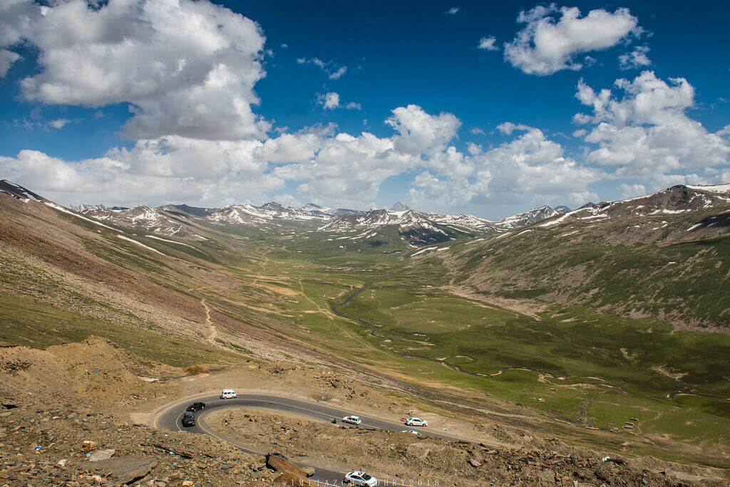
We pass via the Babussar Pass (4,173m) before descending into Tarashing, our home for the next two nights. The lodging is a basic guesthouse with twin beds and outdoor facilities with bucket showers. Bed linen and blankets are provided.
The overall driving time is about five to six hours, with plenty of time for picturesque pauses.
Day 04: Drive into the Upper Rupal Valley for a walk up to Nanga Parbat Base Camp (3550m)
This morning, we drive to the Upper Rupal Valley, then trek five km to Herligkoffer Base Camp, the eastern-facing base camp on the lower slopes of the towering Nanga Parbat. The hike leads us through a gorgeous meadow as we follow the Bazhin Glacier up to a wonderful spring, where the camp begins. The camp is named for Dr. Karl Herrligkoffer, the commander of the first expedition to successfully scale the world's ninth tallest mountain, and it provides excellent close-up views of Nanga Parbat and the adjacent western-Himalayan range. The whole length of the walk is about 10 km, with about 400 meters of ascent/descent, and it takes about three to four hours. Those who do not prefer to participate in today's hike can take a 4WD trip of the Upper Rupal Valley, stopping at a magnificent viewpoint and walking through the hamlet.
After the walk, we drive to Tarashing, our overnight destination. Tonight's lodging is a basic guesthouse with twin bedrooms and outside restrooms with bucket showers. Bed linen and blankets are provided.
Day 05: Travel up and across the Deosai Plateau to Skardu, stopping at Satpara Buddha and Satpura Lake along the way
Today will be a long but rewarding day of driving as we make our way out of the Astore Valley and up to the 4,100-metre-high Deosai Plateau. The plateau was designated a national park in 1993 to help safeguard a critical habitat for the Himalayan Brown Bear, and it is one of the world's highest alpine meadows. The Bara Pani River winds through the national park, supplying multiple high-altitude lakes and creating the ideal climate for wildflowers to thrive. We'll stop at Satpura Lake, whose water has a sparkling blue color since it's supplied primarily by the plateau's melting glaciers. We'll then dismount to stretch our legs on a two-kilometer walk around Sheosar Lake's dark-blue, reflected waters. We arrive in Skardu in the early evening after continuing on by 4WD.
Day 06: Spend the day exploring the Skardu Valley's towering forts and towns
We leave early this morning in our 4WD cars, first stopping in Shigar hamlet to tour Shigar Fort and the 400-year-old Amboriq Mosque. This magnificent and extraordinary piece of Islamic architecture is made completely of wood and has been designated a UNESCO World Heritage Site.
We'll stop at Shigar for lunch and have some typical Balti fare. Look for 'Chapsuro' - a calzone-like bread packed with delicately spiced mince and veggies, 'Gittey' - a type of sausage made with chili and coriander, and 'Mamtu' - delectable stuffed dumplings common in Himalayan regions. After lunch, we'll head to the Katpana Desert, a high-altitude desert with rolling sand dunes that can sometimes be found blanketed in snow during the winter months.
On the way back to Skardu, we'll take a short stroll up to the 16th-century Kharpocho Fort. The Fort appears to be situated dangerously on the cliff face, yet its location provides crucial views of the confluence of the Indus and Shigar Rivers. The trek will take about two hours, including time spent in the Fort.
Day 07: Rejoin the Karakoram Highway and drive to Gilgit, the Karakoram region's core
We left Skardu Valley this morning in our usual 4WD vehicles, going via the northern loop out of the valley, rejoining the Karakoram Highway at Jaglot, and continuing on to Gilgit, a five-hour drive.
We arrive in Gilgit for lunch and then go on a tour of this bustling town in the afternoon. The town, located in the heart of the Gilgit-Baltistan area, is a paradise for hikers, cyclists, mountaineers, and adventurers, not to mention passing traders. It is a hive of bustle that is slightly offset by the tranquil snow-capped mountains that surround it. We'll walk through Gilgit's bazaar and then to the Gilgit Bridge. This 158-metre-long suspension bridge spans the width of the fast-flowing Gilgit River and is the region's oldest suspension bridge, dating back to the Raja period. We'll also go to the ancient British Cemetery and see the Kargah Buddha, a 7th-century rock carving that recalls the town's role in spreading Buddhism along the Silk Road and throughout the region.
Day 08: Drive to Karimabad, explore the mighty Baltit Fort, and take in a sunset over the Hunza Valley
We continue along the KKH to the relatively quiet town of Karimabad. We stop en route at a viewpoint with a panoramic view of Rakaposhi, a 7,778-metre-high peak that juts out of the terrain and towers above other adjacent mountains. When we get to Karimabad, we visit the 700-year-old Baltit Fort, which served as the historic seat of the Kingdom of Hunza. The fort's architecture is stunning and has a Tibetan feel to it; in fact, many people compare it to Lhasa's famed Potala Palace. We end the day by heading to Duikar Village, another location with spectacular long-range views, to watch the sun set into the Hunza Valley below. With this scene in front of us, it's clear to see why this valley is commonly regarded as the basis for the legendary utopia 'Shangri-La' in James Hilton's renowned novel.
This evening, we join a local Huzakut family in their house in a tiny village outside Karimabad for an evening dinner. We get a fascinating insight into the way of life for many villagers in the region, and we try a variety of local dishes like 'Buttering Daudo' - a traditional apricot soup, 'Chap Churo' - a delicious pie stuffed with mincemeat between two pan-fried flatbreads, and 'Burish Chapik' - cheese chapattis with crushed almonds.
Day 09: Full day exploring the Hunza Valley with a walk on Hoper Glacier
We leave early this morning by four-wheel drive to the Hope Valley, which is home to three massive glaciers: Hoper, Barpu, and Mier. We leave our vehicles behind and walk for about an hour and a half, stopping for a picnic lunch in front of this amazing glacier. Please keep in mind that this trek is steep in spots and has some exposed areas. We go on to Passu in the afternoon to visit (but not cross!) the Hussaini suspension bridge. This basic work of engineering, which spans 64 meters across the Hunza River, is nothing more than a collection of generously spaced, rotting timber planks connected together with several lengths of steel cable. It provides a lifeline for the inhabitants, allowing them to convey products and farmland across the fast-flowing river below. After some time spent watching the traffic on the bridge, we'll continue on to Passu, pausing at Borith for spectacular views of the Passu Glacier.
Day 10: Leave the Karakoram Highway and drive to the small town of Gupis
Today, we leave Karimabad and travel along the Karakoram route before turning off and joining the main route that connects Chitral and Khyber Pakhtunkhwa in the west with Gilgit Baltistan in the east. The drive is breathtaking, with wide-open landscapes framed by snow-capped peaks. We stopped several times along the trip, including for a picnic lunch at the gorgeous settlement of Gahkuch, which is located on a broad, sweeping bend of the Gilgit River. After a six-hour trip, we arrive in Gupis, a little riverside village where we will spend the next two nights.
Day 11: Explore the remote Yasin Valley
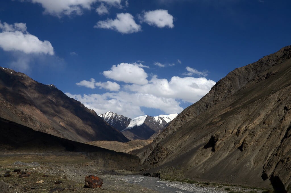
We spent the entire day today exploring the Yasin Valley. This historic location is related to a network of valleys that stretches beyond Pakistan's northwestern border and into the Afghanistan/Tajikistan Wakhan Corridor region. Control of this region has been fought over for ages, from Central Asians competing for the silk trade to British colonial forces more recently. This high-altitude valley is nestled among the Hindu Raj Mountain Range, with a glacial river making its way through the valley bottom and towering 6,000m+ mountains as a backdrop.
This morning, we go from Gupis by 4WD and travel to the village of Darkot, where we will learn about the daily lives of the few residents who live in this sparse, inaccessible mountain location. We then travel to Ghasum, where the road terminates, and leave the jeeps behind to trek the 45 minutes to the snout of the Ghamubar glacier. We stop for lunch overlooking the glacier before continuing on to the beautiful Ghamubar Lake. Later in the afternoon, we return to Gupis. The overall walking time is about 1 hour and 30 minutes, with an altitude increase of about 200 meters.
Day 12: Drive to Naran via the Babusar Pass
Today, we leave the secluded valley area behind and rejoin the main highway, first crossing Babusar Pass (4,100 meters) and pausing at Lulusar Lake before descending back down the Kaghan Valley to Naran. Following check-in, there will be time for a brief orientation tour of the town and its lively main bazaar.
Day 13: Drive back to Islamabad, visit the UNESCO site of Taxila, and then explore Rawalpindi
We dropped back down to the foothills this morning, continuing to lose height as we passed past Mansehra and Abbottabad. Along the journey back to the capital, we will visit the UNESCO World Heritage Site of Taxila, an ancient city that dates back to 3500 BC and has been battled over by the different civilizations that have inhabited this area over the years. Then we go to Rawalpindi's old city. This tightly packed and spreading city, known as the 'Twin City' and part of Islamabad's larger urban conurbation, stands in stark contrast to Islamabad's wide grassy streets. We want to walk through the small lanes, stopping to bargain in the lively Raja Bazaar before returning to the hotel.
Day 14 - Trip ends in Islamabad
Our journey concludes after breakfast at our hotel in Islamabad.
There are no events planned for today, so you may leave Islamabad at any time. If your flight departs later in the day, our hotel has luggage storage services. If you need an airport transfer today, you must fly into Islamabad International Airport (ISB), which is 30-40 minutes away from the hotel.
Holiday Overview
The Karakoram Highway was built as a cooperative effort between Pakistan and China in the 1960s, and it took more than two decades to finish. Since then, the highway has become an important part of Pakistan's road network, acting as a vital trading route between the two countries and encouraging economic and cultural interactions.
The extraordinary elevation of the Karakoram Highway is one of its most impressive features. It traverses a variety of terrains, from the lush green valleys of Abbottabad to the parched plains of Xinjiang, and ascends to some of the world's highest heights reached by any paved road. The highway reaches an astounding elevation of almost 4,600 metres (15,000 feet) at its highest point, the Khunjerab Pass, which is the highest paved international border crossing in the world. This pass connects Pakistan and China and provides travellers with a vantage position to admire the stunning grandeur of the surrounding mountain peaks, including some of the world's tallest, such as K2.
Given the severe environment and difficult terrain, building and maintaining the road is no easy task. Winters provide significant snowfall and avalanches while melting glaciers cause landslides in the summer. Despite these significant obstacles, the Karakoram Highway remains open for the majority of the year, however, it may occasionally close momentarily due to inclement weather.
The Karakoram Highway is an amazing journey that takes travellers through a kaleidoscope of landscapes. The tour begins in Abbottabad and winds through scenic valleys and charming villages, giving travellers a taste of the local culture and way of life. The environment changes dramatically as one travels north, with the road twisting through small gorges, hanging precariously on the sides of cliffs, and providing panoramic vistas of the Karakoram Range.
The route also goes through Gilgit, a historic town and regional commercial and cultural centre. Visitors can visit bazaars, enjoy local cuisine, and learn about the various ethnic groups that live in this region, including the Balti, Hunza, and Shina people.
The awe-inspiring landscapes of the Pamir Plateau greet travellers as they approach the Khunjerab Pass, where steep mountains and clean lakes form a bizarre and compelling scene. The nearby Khunjerab National Park is home to a variety of animals, including the famed Marco Polo sheep and the elusive snow leopard.
The Karakoram Highway is a tribute to human creativity and perseverance, defying natural obstacles to connect two countries and open up opportunities for trade, tourism, and cultural interaction. It is not only a road, but also a symbol of Pakistan and China's long relationship, as well as a doorway to some of the world's most distant and breathtaking environments.
Travellers who take this epic journey down the Karakoram Highway are rewarded with an amazing adventure rich in natural beauty, cultural depth, and a profound sense of awe at the sheer splendour of the Himalayas and Karakoram Mountains.


