K2 Expedition – Karakoram
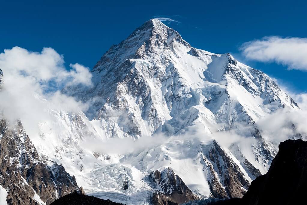
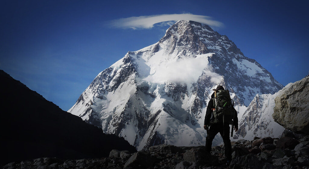
The K2 Expedition is a perilous and audacious attempt to conquer the world's second-highest mountain, K2, popularly known as the "Savage Mountain." This trip takes climbers through dangerous terrain and extreme circumstances to reach the summit of Baltoro Glacier in Baltistan, Pakistan.
The Abruzzi Ridge, also known as the Standard Route or Abruzzi Spur, is usually the route used for the K2 Expedition. This route was first attempted in 1909 by Luigi Amedeo, Duke of the Abruzzi, but it wasn't until July 31, 1954, that an Italian team led by Ardito Desio succeeded. Lino Lacedelli and Achille Compagnoni were the climbers who performed this achievement, leaving their names in mountaineering history.
Trip Highlights
- Very competitive prices for an eight thousand peak
- Field office and permanent staff for logistical arrangements to and from the mountain
- The itinerary is based on our mountain guide's indigenous knowledge and vast experience
- Spectacular mountain vistas during the expedition
- Silkroad Guides is a fully licensed native adventure company
- Fixed departures are normally guided by our Pakistani High Altitude Climber(s) (HAC)
- Private groups are always one of our top priorities
- We cater to both guided expeditions and non-guided (alpine style) climbing
- We cater to both "base camp services" and "full board services"
- Nepalese Sherpas are available upon timely request (at least 6 months prior to arrival in Pakistan)
- The following High Altitude Support available at extra cost
a. Pakistani High Altitude Porter (HAP) - Will carry 20 kg of personal equipment between camps
b. Nepalese Private Sherpa (personal guide/porter) – Carries up to 20 kg (44 lbs) of your personal equipment, climbs with you, melts water, cooks, and will be with you every step of the way.
c. Personal equipment carriage service – Sherpa carries up to 10kg (22lbs) of personal equipment up and down the mountain between camps
Itinerary
The Itinerary of the K2 Expedition is noticeable below
Day 02: Free day in Islamabad
Today's GPS Data Altitude: 540 meters.
Before heading to Skardu, we will receive a briefing from the Department of Tourism in Islamabad about the K2 Expedition.
After the briefing, we will spend time exploring Islamabad and sampling traditional Pakistani cuisine.
Day 03: Fly to Skardu, Karakoram.
Today GPS Data Altitude: 2,498 meters.
Participants will take a beautiful trip from Islamabad Airport to Skardu Airport this morning. If the clouds cooperate, you will be able to view Nanga Parbat. The day is free after arriving at Skardu. Participants can go shopping and relax in the peaceful valley. It'll be a treat before embarking on the K2 Expedition.
Day 04: Enjoy a free day in Skardu
Today GPS Data Altitude: 2,498 meters.
After breakfast, the participants will go to Skardu's Kharpocho Fort, which is positioned on a mountain. The Kharpocho Fort offers a spectacular view of the Indus River and Skardu town. Participants will also have the option of taking a tour of Sadpara Lake, followed by free time in Skardu Bazaar.
During the sightseeing, our personnel will take care of any further government paperwork that is required in Skardu. This can take up to two days. We have contingency days planned at the conclusion of the walk-in in case of delays.
Day 05: Travel to the village of Askole
Today's GPS Data Altitude: 3,015 m
The K2 Expedition will officially begin on this day as we make our way to the Baltoro Region. The participants will begin their jeep safari in the direction of Daso, passing via the Shigar Valley. The journey will take place along the banks of the Braldu River, which runs all the way to Askole. Askole will be the final settlement on our itinerary; after exiting the jeeps, participants will begin walking. However, depending on the road conditions, participants may begin their walk before arriving in Askole. The distance will take you between six and eight hours to complete.
Day 06: Trek from Askole to Jhola across the Biafo Glacier's snout
Today's GPS Data Altitude: 3,103 m
Distance: 20 km
Duration: 5-8 hours
Following the completion of the necessary supply list and equipment, the porters will load up for the journey to Jhola. The valley serves as a portal to the Biafo glacier, which flows over fifty kilometers from Hispar La to Braldu. The participants will experience moraine walking as they traverse the glacier's snout and descend to a picnic site near the Korofon River.
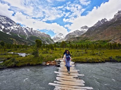
The route will take us to the confluence of the Braldu and Domordo rivers. The former trail will not be used for the journey; instead, a modern trail will take us upstream, where participants will cross the river via a bridge. On the other side of the bridge, competitors will descend to the Braldu River's shore and follow the river bank to the Jhola camp.
Day 07: Following the Braldu River trek from Jhola to Paiju
Today's GPS data Altitude: 3,418 m
Distance: 19.8 km
Duration: 6-7 hours
On this day of our K2 Expedition, participants will follow the Braldu Gorge and the Braldu River's bank. The participants will be able to see the spectacular Trango Tower and Cathedral Peak rocks. Participants should avoid getting sunburned on this day because the walking conditions can be exceedingly dry and hot.
Several glacier streams flow down into the valley, and depending on the water levels, participants will need to utilize river crossing shoes. On a clear day, the trekkers will be able to see the snout of the Baltoro Glacier.
On this day, the participants will climb away from the river to camp at Paiju, the last camp where they will see trees for quite some time.
Day 08: Rest and acclimatize in Paiju
Today's GPS Data Altitude: 3,418 m
The participants will spend the day at Paiju Camp getting acclimated and resting. The porters, on the other hand, will take their time baking bread for the following week on the glacier. On this day, an acclimatisation walk to Paiju Peak base camp is also possible. This will be extremely beneficial for the participants before the K2 Expedition, as their bodies will acclimatize to the location.
Day 09: Trek from Paiju to Khoburtse
Today's GPS Data Altitude: 3,788 m
Distance: 14.7 km
Duration: 5-7 hours
The walking on this day of the K2 Expedition will be difficult, but the landscape will become more spectacular with each step onto the snout of Baltoro Glacier. The trail involves continual up-and-down climbs on the glacier moraine, and while the trail is relatively safe, it is strongly advised to be cautious at all times. As they go, the participants will be treated to breathtaking vistas of Trango Tower and Uli Biaho. The participants must cross the glacier to reach Liligo.
The participants will next walk a steep road along the edge of the Baltoro or sometimes to Khoburtse, the side of the glacier where camp will be set up.
Day 10: Cross small glaciers and walk to Urdukus
Today's GPS Data Altitude: 3,905 m
Distance: 6.4 km
Duration: 4-6 hours
Trango Towers can be viewed on this day of the K2 Expedition after passing through two minor glaciers. The players would spend the night in Urdukas, near the army camp, the next night. The camp is located 100 meters above the glacier.
Day 11: Trek to Goro II, the meeting point of the Baltoro and Young Husband glaciers
Today's GPS Data Altitude: 4,285 m
Distance: 11.9 km
Duration: 6-8 hours
The participants of the K2 Expedition will be strolling in the middle of the glacier on this day. The medial moraine will be followed, with views of Masherbrum (7821m) to the south. The athletes will be hiking up and down the rocky moraine and walking by large ice seracs as they progress.
This will be the first night of camp on Baltoro Glacier at Goro II, which is located at the junction of Baltoro Glacier and Younghusband Glacier. The temperature could plummet drastically. Masherbrum and Muztagh Tower will be revealed for the occasion.
Day 12: Trek to Concordia through a rocky moraine
Today's GPS Data Altitude: 4,512 m
Distance: 11.7 km
Duration: 5-7 hours
On this day of the K2 Expedition, the participants will reach Concordia after trudging up the moraine continually, with more and more high snowcapped peaks appearing along the route, culminating in the sighting of K2. Broad Peak, Mitre Peak, Gasherbrum, Sia Kangri, and many other summits may be viewed.
Day 13: Trek to K2 Base Camp
Today's GPS Data Altitude: 5155m
Distance: 10 km
Duration: 6 hours
Today, you can walk up the Godwin-Austen glacier, which is immediately before the K2 Base Camp. We will leave early in the morning, crossing the glaciers onto the thin track leading to K2 (the trail is all rocky). The mountain appears to grow larger and larger as we follow the glacier toward K2. Broad Peak appears to our right, and we pass the base camp after around 3 hours. We generally stop here for lunch and continue on with K2 looming over us as we approach closer and closer.
The Art Gilkey Memorial is located just before base camp, among the rock and ice-strewn landscape. A brief scramble gets us to the memorial for those whose lives K2 claimed. Plaques and etched tin plates are affixed to a small rocky outcrop at the base of this massive mountain. There are fantastic views of K2 straight above us. We'll spend the night here.
Day 14 - 43: Ascent of K2
Today's GPS Data Altitude: 5,150 m
Distance: 8.08 km
Duration: 4 weeks
We shall begin our ascent to the mountain on this day and continue for the next four weeks. We will have backup days in case the weather improves. The Silkroad Guides Team will set up the K2 Expedition's base camp and will continue to help the expedition throughout the time frame.
Day 44: Return trek to Concordia and rest
Today's GPS Data Altitude: 4,512 m
Distance: 11.7 km
Duration: 5-7 hours
On this day, we return to Concordia after completing the successful K2 Expedition.
Day 45: Trek to Ali Camp
Today’s GPS Data Altitude: 4,500 m
Distance: 14.7 km
Duration: 5-6 hours
The participants will take a little different and less traveled path. There will be short detours to avoid crevasses, and participants should walk on tough ice rather than slick ice. In the event of snow, the participants and porters will walk together while wearing crampons and roped together.
The base will be established in Ali camp, which participants will arrive at after hiking for 5-6 hours. The name "Ali Camp" comes from a local porter who was the first to traverse the Gondogoro La Pass.
Day 46: Trek to Khuispang over Gondogoro La
Today's GPS Data Altitude: 5,585 m
Distance: 19.8 km
Duration: 5-7 hours
Participants will be up as early as 2 a.m. on this day. After getting ready and eating breakfast, the group will depart as one team for the Gondogoro La base. Depending on the situation, our support personnel will be on hand to repair ropes or assist members with equipment. The trip to the top of Gondogoro La Pass takes about 3 hours. You will be able to see and experience all four 8000ers in the Baltoro region. K2, G1, Broad Peak, and G2.
Fixed ropes will be used extensively while descending to the other side, and the usage of crampons is critical for the members' safety. Members will get views of the stunning and sword-shaped Laila Peak (6,096m), as well as vistas of other Trinity summits.
To avoid jolting stones on their teammates, the members will have to be extremely cautious when descending and look out for every step they take. The routes grow easier as the participants descend the slope and go along the moraine. The camp will be located at Khuispang (4,600m), the meeting point of the Gondogoro and Trinity Glaciers.
Day 47: Trek to Saicho
Today's GPS Data Altitude: 3,350 m
Distance: 20 km
Duration: 5-7 hours
The participants will continue hiking down. Because the descent will be a relatively easy hike, the climbing equipment, such as ropes and crampons, will be packed while descending. The rough and mountainous terrain will be carried over the lovely green landscapes of Hushe Valley.
After lunch, the hikers will proceed to the edge of the Gondogoro Glacier, where they will find a track that will lead them to a magnificent valley of rhubarb and grass.
There are two routes to the destination at the valley's end. Our guide, with the help of local porters, will choose the most popular treks.
When the two pathways intersect, the journey becomes much easier. The members will visit stone cottages built by herdsmen and local inhabitants. The participants will see the signs of the villages in the vicinity on this day and will be able to breathe easily due to the large trees and lower altitude. The camp will be put up at Saicho (3,350m), a sand and grassy area along the flowing glacier water streams.
Day 48: Trek to Hushe and drive to Skardu
Today's GPS Data Altitude: 2,498 m
Distance: 20 kilometres trek + 127 kilometres drive
Duration: 5-7 hours trekking + 6 hours driving
On this day, participants must hike down the river stream of glacier-melted water from the Charakusa, Ailling, Masherbrum, and Gondogoro Glaciers for only 3-4 hours. The participants will begin to notice signs of dwellings, shelters, fields, and people living.
The participants will see the Hushe village's two-story shelters, where the ground floor is for cattle and the first floor is for the family to live. Participants can explore the picturesque hushe valley and connect with the locals after setting up their camp. This would be the Gondogoro La Trek's final camping day.
When the participants arrive at Hushe, they will depart towards Skardu town, and the route will take them through many magnificent scenes of the Hushe Valley's various little villages. To reach to the other side, the participants will traverse a suspension bridge spanning the Shyok River (which flows from Ladakh, India).
Traditional rafts constructed of goat skin and filled with air were used to traverse the river in the past. The suspension bridge that is now used to traverse was erected in the 1990s. The participants will arrive in Khaplu after crossing the bridge.
The road from Khaplu to Skardu becomes smoother, and the option to take is the paved road along the Shayok River, which leads to the Indus River's confluence. Participants will arrive in Skardu in 4 hours after traveling along the Indus River. The participants can use the amenities that they did not have for the previous two weeks. The first item on the list would be a hot shower, followed by a satisfying supper.
Day 49: Skardu debriefing
Today's GPS Data Altitude: 2,288 m
Following the completion of the K2 Expedition, the participants will get a debriefing from the Department of Tourism on this day.
After the debriefing, the participants can relax and explore the valley in peace.
Day 50: Travel to Islamabad by plane
Today's GPS Data Altitude: 538 m
On this day, the participants will fly from Skardu Airport to Islamabad Airport. You will have a pleasant time relaxing at the Islamabad Hotel.
Domestic flights are occasionally canceled due to weather conditions. If your flight is canceled, you will drive to Chilas for the night. A vehicle takes eight to 10 hours.
Day 51: Flight cancellation contingency day
This day is set aside for any potential delays if the domestic flight does not operate the day before. Our guests will travel from Chilas to Islamabad in the early morning, which could take up to 10 hours. However, if the players make it to Islamabad on the domestic flight, it would be a free day. This time can be used for finishing paperwork and touring.
Day 52: Fly back to your home country
Meals for this day included: Breakfast
Our personnel will transport all of our customers to the airport at their scheduled departure times. All of our partner hotels have a 12 pm check-out time.
Holiday Overview
The ascent begins at about 5,400 meters (17,700 feet) when the climbers create the Advanced Base Camp. They proceed through a sequence of ice fields, rock ribs, snow slopes, and technical rock climbing portions. The route's highlights include the difficult "House's Chimney" and the towering "Black Pyramid."
Climbers encounter dangerous and exposed slopes beyond the Black Pyramid that lead to a notable landmark known as the "Shoulder." By completing this portion, they will be one step closer to the ultimate challenge: the "Bottleneck." This perilous route is located dangerously close to hanging seracs, which are enormous ice slabs suspended above. The collapse of one of these seracs in 2001 resulted in no successful summit attempts in the following years and the terrible loss of several lives as climbers were forced to descend through falling ice slabs.
The K2 Expedition is famous for its difficulty and technical challenges that rival those of Mount Everest. This mountain's ascent necessitates remarkable physical and mental endurance, as well as advanced mountaineering skills. Only those with immense drive, skill, and a deep respect for the mountain's force and unpredictable nature are brave enough to attempt this amazing achievement.
Conquering Savage Mountain as part of the K2 Expedition is an accomplishment that will go down in mountaineering history. It is a monument to the irrepressible human spirit and the goal of breaking new ground, creating a lasting legacy for future generations of adventurers.


