Around Nanga Parbat Trek (Circular)
The Nanga Parbat trek is an amazing round journey in Pakistan's Western Himalayas. It has grown in popularity among climbing enthusiasts and trekkers from all around the world throughout the years. This journey provides a unique and engaging perspective for all mountain lovers.
Nanga Parbat, a spectacular peak amid Pakistan's mesmerizing landscapes, stands towering at an elevation of 8,126 meters (26,660 ft). It's known as "Killer Mountain," and it's an exciting challenge for seasoned climbers. The hike around Nanga Parbat, on the other hand, caters to both expert mountaineers and trekkers looking for a breathtaking journey.
Trip Highlights
- Base camp of world's 9th highest mountain, Nanga Parbat
- Experience Karakoram Highway
- Night stays at Fairy Meadows
- Bonfires and music at base camp
- Tatu Jeep Safari - ultimate adrenaline rush on one of the most scenic roads in Pakistan
- Alpine forest
- Valleys of Himalayas
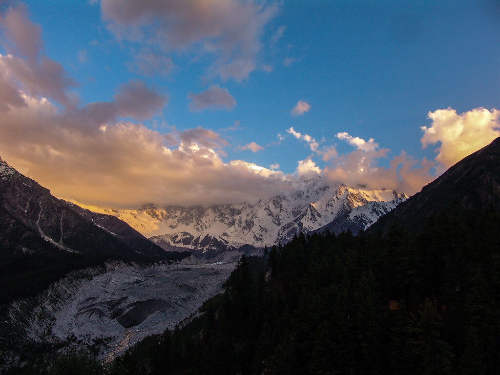
- View of Indus river and Raikot glacier
- Amazing sunsets and sunrises.
- Meet mountaineers at base camps
- Sightseeing in Islamabad
Itinerary
The itinerary for the Around Nanga Parbat trek is given below.
Day 02: Travel to Chilas.
Today GPS Data
We will travel on the highway through Wah, Haripur, and Abbottabad. When we get in Mansehra, we shall take the Naran-Gilgit Road. We will travel through the Balakot, Naran, and Jalkhad valleys. We will pass through Babusar Pass and into Gilgit-Baltistan. We will descend from the pass and proceed on the Karakoram Highway to Chillas. We will check into a hotel in Chillas and spend the night there.
Day 03: Travel to Astore.
Today's GPS Data
On this particular day, we shall travel to Astore. We shall proceed on the Karakoram Highway after passing via the Raikot Bridge. As we continue driving, we will have a commanding glimpse of Nanga Parbat, which towers over the other mountains as the lone authoritarian. We shall also witness the convergence of three enormous mountain ranges, namely the Himalayas, the Karakoram, and the Hindukush. From Jaglot, turn right towards the bridge that joins Gilgit and the Astore Region, and continue on our journey to Astore. We'll be spending the night at Astore.
Day 04: Trek to Tarashing
Today's GPS Data Altitude: 2,900 m
Duration: 3 to 5 hours.
On this day, we will continue our adventure in the Jeeps on the off-road track, which will take us around 3 to 4 hours to reach our first camp destination of Tarashing in the Rupal Valley. This valley is densely forested, and the meadows are rich green and lovely. We'll spend the night here.
Day 05: Trek to Herligkoffer Base Camp
Today's GPS Data Altitude: 3,600 m
Duration: 3 to 5 hours.
We will continue our walk from Tarashing to Herligkoffer Base Camp (3600m) on this day. We will journey through verdant farms and lovely meadows and pass the snout of Tarashing Glacier. We will relax along the road before continuing on our journey to the Herligkoffer Base Camp. When we arrive, we will set up camp adjacent to the Bazhin Glacier. From here, we'll get spectacular views of Raikot Peak and the Chongra Peaks of the Nanga Parbat Massif.
Day 06: Trek to Latobah
Today's GPS Data Altitude: 3,650 meters.
Duration: 5 to 7 hours
On this day, we continue our journey to the well-known Latobah Campsite, passing through the Bazhin Glacier. The campsite is directly beneath the Rupal Face of the Killer Mountain - Nanga Parbat. The Rupal Wall rises 5000m to the summit and is an uncommon site to see.
Day 07: Trek to Shaigiri
Today's GPS Data: 3,700 m
Duration: 3 to 5 hours.
This day will be a little longer than usual. On this day, we will pass the Shaigiri Glacier's snout. On this day, we shall witness the wonderful and stunning view of the Rupal Face.
Day 08: Trek to Mazeno Base Camp
Today's GPS Data Altitude: 4,000 meters.
Duration: 3 to 5 hours.
The views of the Mazeno peaks are spectacular from here. On this day, we will travel via various alpine terrain. We will cross streams, forests, and pastures on our way to the Mazeno high-altitude meadows. On this day, we will see a lot of peaks.
Day 09: Trek to Mazeno High Camp
Today's GPS Data Altitude: 4,700 meters.
Duration: 5 to 8 hours.
On this day, we shall begin our journey to the Mazeno High Camp. We'll be hiking up rough terrain today, with the goal of reaching Mazeno Glacier at the end of our journey. This day will be exhausting in comparison to the rest of the trekking days, but this camp will be rewarding in many ways.
Day 10: Trek to Laibh Meadows
Today's GPS Data Altitude: 4,200 m
Duration: 8 to 10 hours.
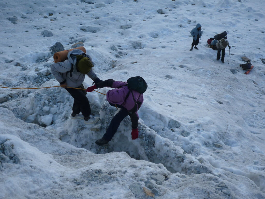
This will be a difficult day because we will ascend the Mazeno Pass (5399m) and then descend to Laibh Meadows. The descent will be more difficult than the ascent because we will be trekking down steep slopes. The crew will be of aid because they are familiar with the terrain, and ropes will be fixed for seamless assistance.
Day 11: Trek to Zangot
Today's GPS Data Altitude: 2,700 meters.
Duration: 6 to 8 hours.
After a few days in the wilderness, we shall enter the first human civilization on this day. We'll be walking through the fields. This day's trek will also include descending mountainous terrain, although it will be less tough than the Mazeno Pass.
Day 12: Zangot Rest
Today's GPS Data Altitude: 2,700 meters.
On this day, we will rest at the Zangot and visit the surrounding environs.
Day 13: Trek to Kutagali
Today's GPS Data Altitude: 3,000 meters.
Duration: 5 to 7 hours.
On this day, we will begin going towards Kutagali, a summer community of shepherds, and we will follow the trail they utilized.
Day 14: Trek to Shaichi
Today's GPS Data Altitude: 2,900 m
Duration: 5 to 7 hours.
On this day, we will cross the Karu Sagar Pass (4900m), which is less challenging than the previous passes on the route. We will arrive in Shaichi with magnificent views of Nanga Parbat's Diamir Face, and the vistas will improve as we continue.
Day 15: Trek to Gutum Sagar
Today's GPS Data Altitude: 3,500 m
Duration: 6 to 8 hours.
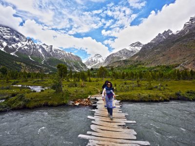
We will go through the Pine Forest and upland pastures on this day. Throughout the day, we will cross streams at various points.
Day 16: Trek to Jilipur High Camp.
Today's GPS Data Altitude: 4,300 meters.
Time required: 6 to 8 hours.
On this day, we'll walk to Jilipur High Camp. We will enjoy breathtaking views of the Jilipur Peaks on this day. On this day, you will observe the splendor of the Himalayas.
Day 17: Trek to Beyal Camp
Today's GPS Data Altitude: 3,400 meters.
Duration: 7 to 9 hours.
On this day, we hope to arrive at Beyal Camp. We will accomplish it by traversing the 4,840-meter-high Khutsu Pass. It is not a difficult pass to traverse, but we must exercise extreme caution in the event of any trouble. We'll have to climb hard terrain to reach the pass, then drop to Beyal Camp. On this day, we will camp beside the Raikot Glacier.
Day 18: Fairy Meadows
Today's GPS Data Altitude: 3,200 m
Duration: 2 to 3 hours.
We will complete the Nanga Parbat Base Camp Circuit on this day and witness the spectacular grandeur of this beautiful summit. The gorgeous landscape and meadows will have a wonderful effect on your soul, and you will want to stay there forever.
Day 19: Return to Chilas
On this day, we will walk down to Tatu Village and then take a Jeep to Raikot Bridge. The jeep ride will be an additional adventure on this excursion, as you will see the deep gorge on the other end. When we get to Raikot Bridge, we will go to Chillas Town and spend the night there.
Day 20: Take the Babusar Pass to Islamabad.
We'll be driving from Chillas to Islamabad on this day. If the weather permits, we will leave early and travel via Babusar Pass, otherwise, we will take the alternate route through Besham. We'll spend the night in Islamabad.
Day 21: Islamabad Sightseeing
This is typically a contingency day in case of any shortfalls due to various circumstances. However, if we are on time, we will visit Rawalpindi and Islamabad on this day and get some rest and sleep before flying out.
Day 22: Fly back to your own country.
Meals for Today: Breakfast
All of our visitors will be driven to the airport by a member of our team.
Holiday Overview
The Nanga Parbat trek's circular path allows explorers to visit a variety of natural treasures. This excursion will take you through breathtaking valleys, crystal-clear glacial streams, lush forests, and gorgeous meadows covered with bright wildflowers. The surrounding surroundings exhibit the Western Himalayas' raw beauty and grandeur.
Throughout the journey, you will be able to experience the rich cultural legacy of the region's local villages. The people's warm warmth and welcoming disposition will make a lasting effect on your journey. Their manner of life, traditional cuisine, and distinctive rituals complement the overall experience.
It should be noted that the Nanga Parbat hike necessitates meticulous planning and preparation. It is advised for experienced hikers or those with mountaineering skills because to its difficult nature and high-altitude circumstances. Acclimatization and physical conditioning are essential for a fun and safe experience.
The Nanga Parbat hike promises to be a memorable experience that will allow you to connect with nature in its purest form. It provides an opportunity to push your limits, view stunning scenery, and make lifelong experiences in the heart of the Western Himalayas.


