Roghili Gol
Roghili Gol, located on the southern slopes of Izghor within Golen Gol, is a tribute to the raw beauty of the untamed wilderness. This picturesque valley, called after its numerous cedar (rogh) forests, provides an enthralling hike that reveals nature's stunning tapestry.
Itinerary
The Itinerary for Roghili Gol is noticeable below
Day 02: Lochuk to Buthijhal
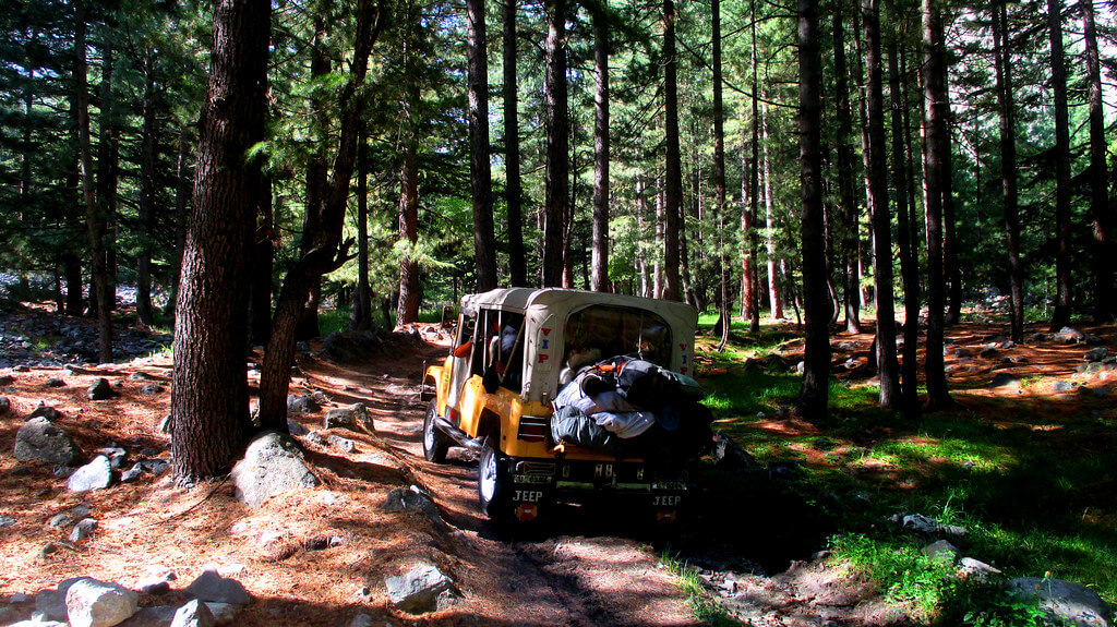
Continue up the trail through the pine forest, passing a few cabins along the way. The forest will be gone in 15 minutes. Ibex herds live in Kundar Gol, a side stream to the east. Livestock overgrazing is evident. Continue ascending up the steep path along the true left bank of the Roghili Gol as the trail fades. Many of the willows that line the stream have been chewed away by goats. Buthijhal (3030m) takes one to eleven hours to reach. West of the stream, large birch trees (buthi) can be seen. Buthijhal also serves as a grazing area and has a few cottages. Canals on both sides of the valley may be confused for pathways.
Day 03: Buthijhal to Lut Chhat
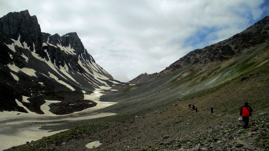
In 15 minutes, pass through another little farmed region with a few cottages at the base of cliffs, directly in the route of a possible rock fall and avalanche. For one hour, ascend stony rubble to a few scattered birch trees (3240m) on a rise. Continue up the valley as it narrows and heads southwest. Pass through the narrow canyon (tang) and arrive at the first of two aqua lakes, Tsak Chhat (3682m), 112 to two hours from Buthijhal. The trail continues up the true left (west) side of the creek for 1.25km to the second lake, Lut Chhat (3765m). Beyond the lake are two difficult passes: Roghili Gree and Roghili An (see Jughor and Roghili An under Other Treks for further information).
Jughor
Jughor hamlet, located at the mouth of the Jughor Gol, is located south of and across the river from Chitral town. Plan to go to Jughor the day before you start to organize any treks. There are four difficult passes at the valley's head: two south to Shishi Gol and two east, one to Koghozi Gol, and the other to Roghili Gol.
Walk up the valley from Jughor to a cabin at Chhato Shal (3048m), where the route crosses to the true left bank. Continue for another 750m to a trail intersection (3161m). One track ascends the Kapashung Gol to the passes to Shishi Gol, while the other ascends the Bungolbahan Gol to the other two passes.
Father is split valley by the Kapashung Gol route. The path to the southeast traverses the Domukh An (4380m) and leads to Kalas in Shishi Gol. The route to the south follows the actual right bank of the Kapashung Gol for 3 kilometres, via the highest branch, to Kapashung Gree (4318m), which also goes into Shishi Gol.
The east route up Bungolbahan Gol follows the true left (south) bank and has two possibilities. To begin, proceed 3 3-kilometer valley from the 3161m trail intersection and cross the river. A strenuous 500m ascent north leads to Koghozi An (4480m), after which a steep descent into the Koghozi Valley leads to Koghozi hamlet on the Chitral-Gilgit route. This is a challenging Class 3 cross-country route.
Second, you can climb half a kilometer further northeast along the true left bank of the Bungolbahan Gol to Roghili Gree (4638m). Then it's an 850m scree drop into the upper Roghili Gol basin. The basin is labeled Angarbah on the Chitral (I- 42 F) sheet, however, the locals are unfamiliar with this name. Follow the south bank of a creek 8 kilometers northeast to Lut Chhat (3764m), a lake. You can head north down Roghili Gol from a trail junction 500m above the lake by crossing the stream supplying the lake and contouring down its north bank (see the Roghili Gol hike). You could also cross the Roghili An.
A Roghili
A trail crosses the Roghili An (4496m) to Madaglasht in Shishi Gol from Lut Chhat in the upper Roghili Gol (see the Roghili Gol trek). Continue along Lut Chhat's north and west shores. Continue 500m beyond the lake and cross the stream to its south side. Two paths diverge here, one leading to the Roghili An and the other to the more difficult Roghili Gree (see Jughor, above). The difficult approach to Roghili An (4496m) takes a southeast bend and climbs a rocky ridge to Madaglasht in Shishi Gol.
Day 04: Lut Chhat to Izghor
Return to Izghor from the lakes with ease.
Holiday Overview
The journey through Roghili Gol is a symphony of natural delights, with each step revealing a new aspect of its magnificence. The journey begins by following the crystal-clear streams that meander through deep cedar trees. The forest envelops you in the rich aroma of pine as you stroll slowly on this path, while the musical sound of flowing water becomes your constant companion.
The environment changes with each elevation, becoming alpine meadows decorated with a brilliant blanket of wildflowers. Nature displays its artistic talent here, painting the landscape with a rainbow of colors that dance in the sunlight. Nature's craftsmanship knows no limitations in this sight right out of a dream.
The genuine jewels of Roghili Gol, however, await in its higher alpine basin—two beautiful blue lakes that nestle like rare diamonds amidst the rough terrain. These magnificent bodies of water not only fascinate the sight, but they also provide a home for stately ibex and the rare snow leopard. The lakeshores provide a calm haven, a place to pause and take in the beauty of this unspoiled wilderness.
Roghili Gol is a fascinating voyage into a realm where nature paints its masterpiece in every direction. It's a spot where cedar forests, alpine meadows, and pure lakes coexist to create an enchanting and timeless scenery. It's an opportunity to be immersed in the natural world's treasures, to see the delicate balance of life in a rough landscape, and to connect with the wild beauty of Roghili Gol.


