Five 8,000m Base Camps Trek – The Big Five
Our five base camp trek to 8,000 meters includes a breathtaking hike up the massive Baltoro Glacier, K2 Base Camp, Gasherbrum I & II Base Camp, over the Gondogoro La, and into the picturesque Hushe Valley. It also entails traveling to Fairy Meadows in order to walk to Nanga Parbat's base camp.
We have a very competent and professional crew to accompany you on this incredible tour. They are among the best in Pakistan's Gilgit-Baltistan. The crew is very skilled at meeting all of the demands of the participants and contributes significantly to the overall success and happiness of our groups.
ATP also offers the greatest itinerary in terms of acclimatization, fun, and safety, as well as easy trip customization. Our journey takes place in an area with around 50 7,000-meter summits and 70 6,000-meter peaks. It is an adventurer's dream come true, and one life is insufficient to explore the region.
Trip Highlights
Highlights
- K2 (8,611) and Broad Peak (8,051m) Base Camps
- Gasherbrum I (8,080m) and GII (8,035m) Base Camps
- Nanga Parbat (8,126m) Base Camp
- Staying the night at K2 Base Camp
- Stay the night at Gasherbrum I (8,080m) and GII (8,035m).
- Staying the night at Nanga Parbat Base Camp
- The Gondogoro La Pass (5,585m) is the highest point in the region. From one location, you can see four 8,000m peaks (K2, Gasherbrum I & II, Broad Peak) as well as additional peaks (Gasherbrum 4, Laila, Gondogoro Peak, and so on).
- Circular/circuit trek to the picturesque Hushe Valley
- Concordia - Mountain Gods' Throne Room
- Trek via the Vigne and Gondogoro glaciers from Concordia, then to the Godwin Austin glacier via the Baltoro Glacier (5th longest and largest in the polar area).
- Pay a visit to the Gilkey Memorial.
- Views of peaks ranging in elevation from 5,000 to 8,000 metres, such as Gasherbrum 3 and 4, Masherbrum, Mustagh Tower, Bakhordas Peak, Mitre Peak, Crystal Peak, Marble Peak, Biale Peak, Lobsang Spire, Trango Towers, Uli Biaho, Cathedral Peak, Urdukas Peak, and others.
- More views of peaks ranging in elevation from 5,000 to 8,000 metres, including Laila Peak, Chogolisa, and others.
- Glacier views (including Biafo, Vigne, Liligo, Dunge, Muztagh, Biango, Yermanendu, Mandu, and others), glacial lakes, waterfalls, and streams
- Karakoram Highway
- Pay a visit to Fairy Meadows
- Skardu and Islamabad sightseeing
Itinerary
The 29 days itinerary for the amazing five base camp trek is given below.
Day 02: Fly to Skardu in the Karakoram.
Today's GPS Data Altitude: 2,498 m
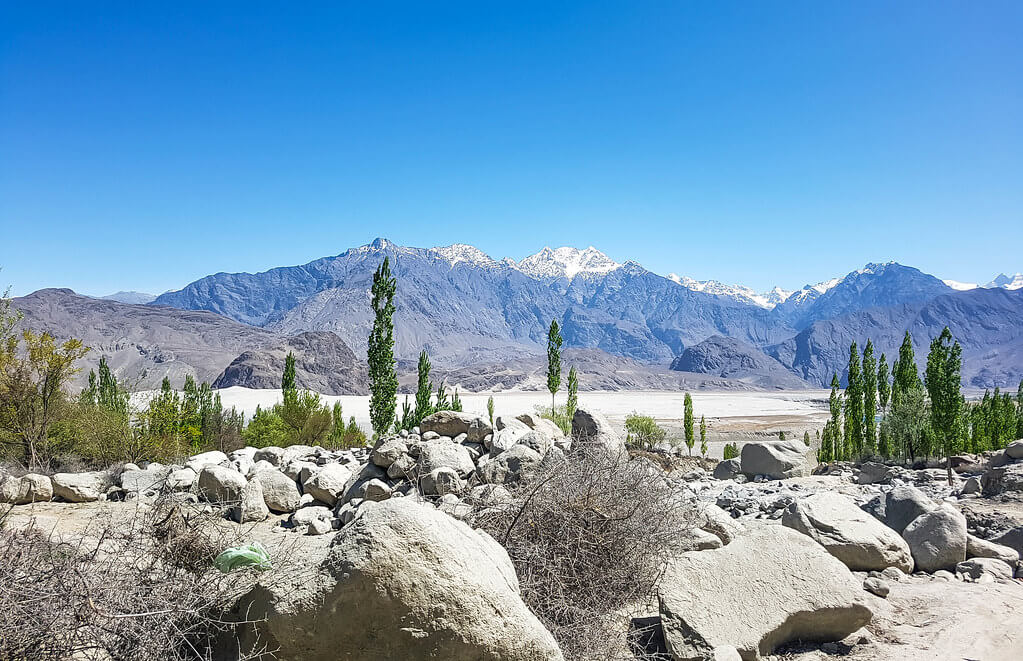
Participants will take a beautiful trip from Islamabad airport to Skardu airport this morning. If the clouds cooperate, you will be able to view Nanga Parbat. The day is free after arriving at Skardu.
Day 03: Enjoy a free day in Skardu.
Today's GPS Data Altitude: 2,498 m
After breakfast, the participants will go to Skardu's Kharpocho Fort, which is positioned on a mountain. The Kharpocho Fort offers a spectacular view of the Indus River and Skardu town. Participants will also have the option of taking a tour of Sadpara Lake, followed by free time in Skardu Bazaar.
During the sightseeing, our personnel will take care of any further government paperwork that is required in Skardu. This can take up to two days. We have contingency days planned at the conclusion of the walk-in in case of delays.
Day 04: Travel to the village of Askole.
Today's GPS Data Altitude: 3,015 m
The participants will begin their jeep safari in the direction of Daso, passing via the Shigar valley. The journey will take place along the banks of the Braldu River, which runs all the way to Askole. Askole will be the final settlement on our itinerary; after exiting the jeeps, participants will begin walking. However, depending on the road conditions, participants may begin their walk before arriving in Askole. The distance will take you between six and eight hours to complete.
Day 05: Trek from Askole to Jhola across the Biafo Glacier's snout.
Today GPS Data Altitude: 3,103 meters.
Distance: 20 km
Time required: 5-8 hours
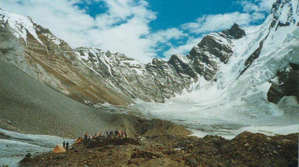
Following the completion of the necessary supply list and equipment, the porters will load up for the journey to Jhola. The valley serves as a portal to the Biafo glacier, which flows over fifty kilometers from Hispar La to Braldu. The participants will experience moraine walking as they traverse the glacier's snout and descend to a picnic site near the Korofon River.
The route will take us to the confluence of the Braldu and Domordo rivers. The former trail will not be used for the journey; instead, a modern trail will take us upstream, where participants will cross the river via a bridge. On the other side of the bridge, competitors will descend to the Braldu River's shore and follow the river bank to the Jhola camp.
Day 06: Follow the Braldu River from Jhola to Paiju.
Today's GPS Data Altitude: 3,418 meters.
Distance: 19.8 km
Time required: 6-7 hours
On this day of our K2 base camp trip, we will follow the Braldu gorge and the Braldu river's bank. The participants will be able to see the spectacular Trango Tower and Cathedral Peak rocks. Participants should avoid getting sunburned on this day because the walking conditions can be exceedingly dry and hot.
Several glacier streams flow down into the valley, and depending on the water levels, participants will need to utilise river crossing shoes. On a clear day, the trekkers will be able to see the snout of the Baltoro Glacier. On this day, the participants will climb away from the river to camp at Paiju, the last camp where they will see trees for quite some time.
Day 07: Rest and acclimatise in Paiju
Today's GPS Data Altitude: 3,418 meters.
The elevation is The participants will spend the day at Paiju Camp getting acclimated and resting. The porters, on the other hand, will take their time baking bread for the following week on the glacier. On this day, an acclimatization walk to Paiju Peak base camp is also possible.
Day 08: Trek from Paiju to Khoburtse
Today's GPS Data Altitude: 3,788 meters.
Distance: 14.7 km
Time required: 5-7 hours
The walking will be difficult on this day, but the landscape will become more spectacular with each step onto the snout of Baltoro Glacier. The trail involves continual up-and-down climbs on the glacier moraine, and while the trail is relatively safe, it is strongly advised to be cautious at all times. As they go, the participants will be treated to breathtaking vistas of Trango Tower and Uli Biaho.
The participants must cross the glacier to reach Liligo. The participants will next walk a steep road along the edge of the Baltoro or sometimes to Khoburtse, the side of the glacier where camp will be set up.
Day 09: Walk to Urdukus across minor glaciers.
Today's GPS Data Altitude: 3,905 meters.
Distance: 6.4 km
Time required: 4-6 hours
After passing through two small glaciers, the Trango Towers can be viewed. The players would spend the night in Urdukas, near the army camp, the next night. The camp is located 100 meters above the glacier.
Day 10: Trek to Goro II, the meeting point of the Baltoro and Young husband glaciers.
Today's GPS Data Altitude: 4,285 meters.
Distance: 11.9 km
Time required: 6-8 hours
The participants on our K2 base camp tour will be strolling in the center of the glacier on this day. The medial moraine will be followed, with views of Masherbrum (7821m) to the south. The athletes will be hiking up and down the rocky moraine and walking by large ice seracs as they progress.
This will be the first night's stay camp on Baltoro Glacier at Goro II, which is located at the junction of Baltoro Glacier and Younghusband Glacier.
The temperature could plummet drastically. Masherbrum and Muztagh Tower will be revealed for the occasion.
Day 11: Trek through a rocky moraine to Concordia.
Today's GPS Data Altitude: 4,512 meters.
Distance: 11.7 km
Time required: 5-7 hours
On this day of the K2 base camp trip, hikers will arrive at Concordia after trudging up the moraine continually, with more and more high snowcapped peaks appearing along the route, culminating in the view of K2. Broad Peak, Mitre Peak, Gasherbrum, Sia Kangri, and many other summits may be viewed.
Day 12: Trek to Broad Peak BC, Gilkey Memorial, and K2 Base Camp
Today's GPS Data Altitude: K2 BC (5,155m) + Gilkey (5,230m) + Broad Peak (4,844m).
Time: 6-7 hours
Today, you can hike up the Godwin-Austen glacier to the Art Gilkey Memorial (an American geologist and mountaineer), which is right before K2 Base Camp. This is a fantastic day. We will leave early in the morning, crossing the glaciers onto the thin track leading to K2 (the trail is all rocky). The mountain appears to grow larger and larger as we follow the glacier towards K2. Broad Peak appears to our right, and we pass the base camp after around 3 hours.
We normally stop here for lunch and then continue on with K2 looming over us as we approach closer and closer.
The Art Gilkey Memorial is located just before base camp, among the rock and ice-strewn landscape. A brief scramble gets us to the memorial for those whose lives K2 claimed. Plaques and etched tin plates are affixed to a small rocky outcrop at the base of this massive mountain. There are excellent views of K2 just above us, and we may see some climbing excursions. We spend the night in K2's base camp.
Day 13: Return to Concordia and rest.
Time: 4-5 hours today
On this day, we return to Concordia and recover in preparation for the next day's walk.
Day 14: Trek to Shahring
Over this day, the hike from Concordia to the campground will take two hours over glacier moraine. The participants will hike on the upper Baltoro glacier to reach Shahring. Participants can see Chogolisa, Snow Dome Peaks, Baltoro Kangri, and numerous more high altitude peaks from this vantage point.
Day 15: Trek to Gasherbrum I & II base camps
On this day of the Karakoram trek, hikers will arrive at the base camps of Gasherbrum I and II and set up camp. Participants will have the opportunity to visit the most pristine and picturesque alpine settings. Participants can unwind or, if they are lucky, interact with mountaineering expedition teams. The participants can wish the climbers luck and bid them farewell for their journey.
Day 16: Return to Concordia and rest.
On this Day, We retrace our steps back to Concordia on this day.
Day 17: Trek to Ali Camp
On Day 13, participants will embark on a little different and less traveled path. To avoid crevasses, short mini-tours will be undertaken, and participants should walk on tough ice rather than slick ice. In the event of snow, the participants and porters will walk together while wearing crampons and roped together.
The base will be established in Ali camp, which participants will arrive at after hiking for 5-6 hours. The name "Ali Camp" comes from a local porter who was the first to traverse the Gondogoro La Pass.
When the participants get to the base, they will be taught some basic techniques for the next day's crossing of the Gondogoro La Pass.
Day 18: Trek from Gondogoro La to Khuispang.
Participants will be up as early as 2 a.m. on this day. After getting ready and eating breakfast, the group will depart as one team for the Gondogoro La base. Depending on the situation, our support personnel will be on hand to repair ropes or assist members with equipment. The trip to the top of Gondogoro La Pass takes about 3 hours. You will be able to see and experience all four 8000ers in the Baltoro region. K2, G1, Broad Peak, and G2.
Fixed ropes will be used extensively while descending to the other side, and the usage of crampons is critical for the members' safety. Members will get views of the stunning and sword-shaped Laila Peak (6,096m), as well as vistas of other Trinity summits.
To avoid jolting stones on their teammates, the members will have to be extremely cautious when descending and look out for every step they take. The routes grow easier as the participants descend the slope and go along the moraine. The camp will be located at Khuispang (4,600m), the meeting point of the Gondogoro and Trinity Glaciers.
Day 19: Trek to Saicho
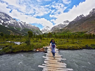
On this day, the participants will continue hiking down. Because the descent will be a relatively easy hike, the climbing equipment, such as ropes and crampons, will be packed while descending. The rough and mountainous terrain will be carried over the lovely green landscapes of Hushe Valley.
After lunch, the hikers will proceed to the edge of the Gondogoro Glacier, where they will find a track that will lead them to a magnificent valley of rhubarb and grass.
There are two routes to the destination at the valley's end. Our guide, with the help of local porters, will choose the most popular treks.
When the two pathways intersect, the journey becomes much easier. The members will visit stone cottages built by herdsmen and local inhabitants. The participants will see the signs of the villages in the vicinity on this day and will be able to breathe easily due to the large trees and lower altitude. The camp will be put up at Saicho (3,350m), a sand and grassy area along the flowing glacier water streams.
Day 20: Trek to Hushe and then drive to Skardu.
Today's GPS Data Altitude: 2,498 meters.
Distance: 20 kilometres hike + 127 kilometres drive
Time required: 5-7 hours hiking + 6 hours driving
On this day, participants must hike down the river stream of glacier-melted water from the Charakusa, Ailling, Masherbrum, and Gondogoro Glaciers for only 3-4 hours. The participants will begin to notice signs of dwellings, shelters, fields, and people living.
The participants will see the Hushe village's two-story shelters, where the ground floor is for cattle and the first floor is for the family to live. Participants can explore the picturesque hushe valley and connect with the locals after setting up their camp.
This would be the Gondogoro La Trek's final camping day.
When the participants arrive at Hushe, they will depart towards Skardu town, and the route will take them through many magnificent scenes of the Hushe Valley's various little villages. To reach to the other side, the participants will traverse a suspension bridge spanning the Shyok River (which flows from Ladakh, India).
Traditional rafts constructed of goat skin and filled with air were used to traverse the river in the past. The suspension bridge that is now used to traverse was erected in the 1990s. The participants will arrive in Khaplu after crossing the bridge.
The road from Khaplu to Skardu becomes smoother, and the option to take is the paved road along the Shayok River, which leads to the Indus River's confluence. Participants will arrive in Skardu in 4 hours after traveling along the Indus River. The participants can use the amenities that they did not have for the previous two weeks. The first item on the list would be a hot shower, followed by a satisfying supper.
Day 21: Skardu contingency day/rest
On this day, our guests will relax and refuel in preparation for the next journey to Nanga Parbat Base Camp.
Day 22: Drive to Raikot, Chilas
On this day, leave early in the morning towards Raikot, Chilas. The competitors will cross the Alam Bridge and proceed along the Indus River, passing through Jaglot and Bunji on their way to Raikot.
Day 23: Drive to Tatu and walk to Fairy Meadows
Today's GPS Data Altitude: 3,300 meters.
We'll leave the hotel after breakfast and make our way to Fairy Meadows. The participants will be transported to Tatu village by 4WD vehicles and will then walk for 2-3 hours to reach Fairy Meadows. Participants can rest, wander around, enjoy short treks, or connect with the locals after they get to Fairy Meadows.
Day 24: Trek to Beyal Camp
Today's GPS Data Altitude: 3,500m meters
A few kilometers after Fairy Meadows, there is another campsite named Beyal, which is much more peaceful and offers even nicer views than the first. The trail becomes more difficult after Beyal, but also more rewarding. The path leads from an alpine woodland to an arid but magnificent environment surrounded by snow and ice boulders.
Day 25: Trek to Nanga Parbat Base Camp
Today's GPS Data Altitude: 3,850 meters.
Participants will begin hiking for a few hours and arrive at Nanga Parbat Base Camp, where the silence is only broken by the sound of avalanches, which can also be heard from afar. The night will be spent in the shadow of the Himalayan Beast (8,126 meters).
Day 26: Return to Fairy Meadows
On this day, participants will go back to Fairy Meadows and enjoy the entire day to themselves once they arrive. Throughout the day, you can write in your diaries, sketch, paint, rest, or picture the killer mountain. The sunrises, sunsets, and full moons are spectacular at fairy meadows.
Day 27: Drive to Islamabad through the Karakoram/Babusar Pass
On this day, the guests will return to Besham or Naran from Fairy Meadows, depending on the weather and other conditions. If we follow the road to Besham, we will pass through Chilas and Dassu as we travel along the Indus River on the Karakoram Highway. We will, nevertheless, attempt to return to Islamabad through the Naran road. This will provide our guests with the possibility to visit new destinations.
Day 28: Islamabad Sightseeing
On this day, the twin cities of Rawalpindi and Islamabad, both of which are distinct, will be toured. Islamabad is a contemporary capital city with excellent viewing opportunities, whereas Rawalpindi is a historic city developed during the British era with intricate bazaars and lively streets.
Day 29: Fly back to your home nation.
Meals for this day included: Breakfast
Our personnel will transport all of our customers to the airport at their scheduled departure times. All of our partner hotels have a 12pm check-out time.
Important Notes
Why Register Now?
1. Early Bird Discount: The given prices for the holiday are limited-time discount offers and are subject to change. Service providers including (but not limited) to airlines and hotels increase prices in peak-season. Early reservations cost us less than peak-season.
2: Limited Space in Peak Months: The peak months in the peak season attract the highest number of international guests and are therefore sold out earlier. We have restricted one group size to a maximum of 15 travelers. We are taking registrations on a "first-come, first-served" basis.
3. Limited Flight Seats: Domestic flight seats to the Karakorams and Himalayas are sold out way ahead of time because there are only two daily flights during peak season. Among other things, the deposit is used to book domestic flights for you in advance.
4. Pay Balance after arrival in Pakistan: We appreciate that paying the final balance for your trip may cause concern. Our policy is to only receive your final balance once you arrive in Pakistan. The only payment before arrival is the deposit.
5. Pay Minimum Deposit: The deposits for the holiday are also early-bird discounts and automatically change according to the late deposit schedule above. The same dates above apply to next season's deposits.
Deposit (Advance) for Pakistani nationals
The deposit for Pakistani nationals is PKR 50,000 or 30% of the total price, whichever is greater. The deposit is non-refundable.
Refund Policy for All
Deposit: Once paid, the deposit is non-refundable as it will be spent on making in-country arrangements. For Pakistan nationals, the deposit is non-refundable in all cases too.
Balance: Pay the balance only after arrival in Pakistan on the first day. Payment guidelines will be shared timely.
Currency
All international travelers can pay in US Dollars (USD) or equivalent in Euros (EUR) or Pound Sterling (GBP). Pakistani travelers are charged the equivalent in Pakistani Rupees (PKR).
Single Supplement
Separate hotel rooms (single supplement) will cost an additional USD 490. This includes all hotel nights. This payment should be made with the balance upon arrival.
Separate tents (single tent) will cost an additional USD 190. This includes the cost of additional porterage. This payment should also be made with the balance in Pakistan.
Holiday Overview
Trek across Baltoro glaciers and Base Camps of five 8000-meter summits to experience the natural beauties of this stunning landscape. Nowhere else on the planet can you witness such breathtaking views of K2 (8,611m), the world's second highest peak, and the world's most stunning high and natural pyramids: Broad Peak (8,048m), Gashabrum I to 6, Golden Throne (7,240m), Chogolisa (7,665m), and the entire upper Baltoro Massif.
The Karakoram region contains 42 peaks that are higher than the highest peaks on all other continents combined. Gilgit-Baltistan is regarded as the "Land of Cultures," and it is not unexpected that there are eight distinct languages spoken there. The majority of the villages and towns in the region are secluded and remote from Pakistan's major urban regions, which is also why the region is so well preserved.
It is a sanctuary of isolation and sophistication, worldwide recognized as one of the world's best trekking and climbing destinations.


