Masherbrum Base Camp Trek
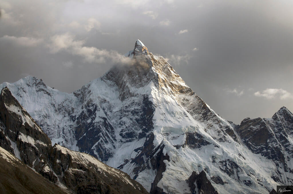
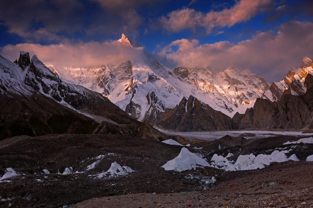
The Masherbrum Base Camp Trek is an appealing and relatively easy trip that takes travelers directly to the base of the daunting Masherbrum Mountain, an imposing peak that rises to a height of 7,821 meters (25,659 ft). This journey is located in the intriguing Ghanche District of Gilgit-Baltistan, Pakistan, and it provides an exceptional opportunity to discover the heart of the Karakoram Mountains while taking in the breathtaking scenery.
Itinerary
The Itinerary for the Masherbrum Base Camp Trek is noticeable below
Day 02: Fly to Skardu
Today's GPS Data Altitude: 2,498 m
Participants will take a beautiful trip from Islamabad airport to Skardu airport this morning. If the clouds cooperate, you will be able to view Nanga Parbat. The day is free after arriving at Skardu.
Day 03: Spend a free day in Skardu
Today's GPS Data Altitude: 2,498 m
After breakfast, the participants will go to Skardu's Kharpocho fort, which is positioned on a mountain. The Kharpocho fort offers a spectacular view of the Indus River and Skardu town. Participants will also have the option of taking a tour of Sadpara Lake, followed by free time in Skardu Bazaar.
During the sightseeing, our personnel will take care of any further government paperwork that is required in Skardu. This can take up to two days. We have contingency days planned at the conclusion of the walk-in in case of delays.
Day 04: Drive from Skardu to Hushe
Today's GPS Data Altitude: 3,050 m
Duration: 6-7 hours
Distance: 120 kilometers
Hushe is the beginning place for our journey. The trip from Skardu to Hushe is breathtaking. The jeep route spans the Shyok River and continues through Khaplu, Macholo, Kanday, and Khane villages.
Day-05: Trek from Hushe to Parbisan
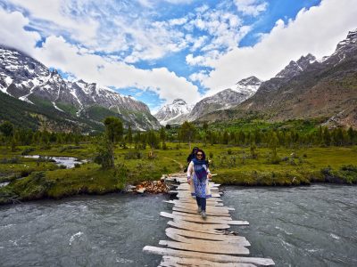
There are two footbridges you can use to cross the Hushe River. A route follows the true right (west) bank of the Hushe River from the lower footbridge, which is located just west of the village. It passes via stone houses used to store fodder as it ascends through fields after crossing the Honbrok brook. A rocky path continues above the east bank of the river. This trail connects to the west bank's trail after crossing a taller footbridge in 45 minutes. Wesuk's huts are 45 minutes away. A shaded clean stream is located 10 minutes farther, close to the summer settlement of Dumsum, after you cross the Aling River on footbridge 30 minutes from Wesuk. Continue 45 minutes down the stony river bed to Parbisan (3475m), a lovely willow grove with a clean spring at the base of a talus slope. Cliffs tower over the river across from Parbisan. Kyipotama is a small, steep side valley just south of the cliffs. The term is derived from a defunct hunting practise. Because there is no way out due to the steep walls, hunters used to deploy (tama) dogs (kyipo) to drive ibex into the valley, where they proved easy game.
Day 06: Trek from Parbisan to Brumbrama
Three to four hours. The trek begins in dense tamarisk jungle, which is swampy underfoot and progresses to tough glacier moraine—a gravelly stretch of sliding stones at the snout of Masherbrum Glacier. Follow the stream up, keeping it to your right, until it comes out of the glacier snout, where a gully drops to the left. Cross the snowdrift at the gully's bottom and continue the extremely vertical, ill-defined trail up the right (north) side of the gully, which leads straight to the summit of the Masherbrum Glacier's western lateral moraine—a one-hour ascent.
You'll need a guide to show you the way, and there might be a smoother trail up the moraine from the tamarisk wood's end. The moraine's crest is a sea of purple vetch in August, with clumps of Columbine, potential, rockroses, and willow plants. The stroll along the top of the moraine, continuously climbing, is the most beautiful part of the hike. You walk amid flowers with spectacular views to your right of the Masherbrum Glacier, south to jagged spires and precipitous cliff sides, and north to Masherbrum Peak.
The Brumbrammah (meaning 'between the mountain and the willow bush') campsite is located on a wide, flat, sandy region surrounded by willow bushes, Edelweiss, and many other flowers. around July, this is a lake, but the water supply runs out around mid-August. Bruni Brama, a side valley leading up to Cathedral, Mitre, Sceptre, and Crown peaks, joins the main valley here.
Overnight stay in a camp
Day 07: Trek to Masherbrum Base Camp
Today's GPS Data Altitude: 4,280 m
Duration: 3-4 hours
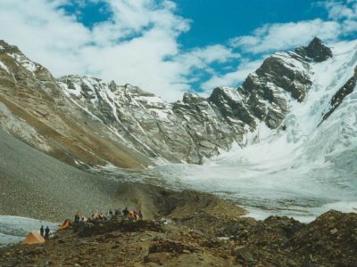
After breakfast at the campground, begin the journey to Masherbrum base camp (4200m) via a lovely trail that runs parallel to the Masherbrum glacier. Afternoon free to explore the base camp lake and neighboring overlooks.
Day 08: Free day at Base Camp
The day is yours to explore your surroundings. You may spend your time relaxing, sunbathing, or reading a book.
Overnight in Camps
Day 09: Return trek to Dumsan
Between four to five hours. Today we will travel one and a half stages back to Hushe. Because we're going down, walking and height won't be an issue.
Camps are where you will spend the night.
Day 10: Trek to Hushe and Drive to Skardu
Return to Hushe and then drive to Khaplu. After lunch at Khaplu Fort, drive to Skardu and check into your accommodation.
Day 11: Fly to Islamabad
Today's GPS Data Altitude: 538 m
On this day, the participants will fly from Skardu Airport to Islamabad Airport. You will have a pleasant time relaxing at the Islamabad Hotel.
Domestic flights are occasionally canceled due to weather conditions. In the event of a flight cancellation, you will spend the night in Raikot or Chilas. A car takes 10 hours.
Day 12: Make-up day for flight cancellations
Today's GPS Data Altitude: 538 m
This day is set aside for any potential delays if the domestic flight does not operate the day before. Our guests will travel from Chilas to Islamabad in the early morning, which could take up to 10 hours. However, if the players make it to Islamabad on the domestic flight, it would be a free day. This time could be spent sightseeing in Islamabad.
Day 13: Fly back to your home country
Breakfast is included
Our personnel will transport all of our customers to the airport at their scheduled departure times. All of our partner hotels have a 12 p.m. check-out time.
Holiday Overview
Masherbrum, also known as K1, is a historic mountain that was the first mapped peak in the Karakoram mountain range. It is proudly the 22nd tallest mountain in the world and the ninth highest in Pakistan. Despite its massive size and stunning presence, Masherbrum is oftentimes eclipsed by the adjacent Karakoram giants, the famed 8,000-meter summits such as K2, Gasherbrum I, Broad Peak, and Gasherbrum II.
The Masherbrum Base Camp Trek is well-known for its comparatively easy terrain, making it accessible to a wide range of trekkers. It works well as a stand-alone trip, allowing participants to immerse themselves in the stunning grandeur of the Karakoram. Furthermore, it can be used as an acclimatization walk for individuals wanting to visit higher-altitude attractions in the Gondogoro Valley.
The trek's itinerary includes a simple glacier walk that takes around thirty minutes and takes trekkers directly to Masherbrum's base camp. Trekkers are treated to a variety of breathtaking landscapes along this scenic excursion, including panoramic views of neighboring mountains. This one-of-a-kind adventure offers a glimpse into the untamed and pristine natural landscapes that define the Karakoram.
Whether undertaken as a stand-alone adventure or as part of a larger Himalayan expedition, the Masherbrum Base Camp Trek guarantees an indelible and unique journey across the harsh, beautiful, and awe-inspiring scenery of Pakistan's Gilgit-Baltistan area. It gives trekkers the rare opportunity to stand in the shadow of Masherbrum's majesty while being entirely surrounded by the untouched beauty of the Karakoram Mountains.


